Thursday, May 1, 2014

Timmangtang Rock Formation, Pagudpud, Ilocos Norte

We had an overnight stay in Pagudpud.  It was already about 8 pm when we reached the place however, even in the dark, the silhouette of the beach was so peaceful and welcoming. We settled in for the night and the next day, we left Pagudpud by about 9 am.

On our way back, we spotted a large solitary rock formation by the coast.  We were excited to stop by to get a closer look of this seemingly mysterious rock. Incidentally, when I went down on our vehicle, i have spotted another rock formation with a hole which was located side by side with that big rock that we saw. Since it was not really very far, I have seen some people by that other rock.


There was a marker that said Timmangtang Rock, hence the name of the rock that we were approaching.  I am an Ilocana and with what I know about "tangtang", it means bell. I tried to research further, and indeed, it got it's name from a bell. Accordingly, they say that the rock formation was shaped like a bell.  To me, I had no inclination on how it appeared like a bell because it didn't.  The other rock was called Bantay Abot Rock formation.

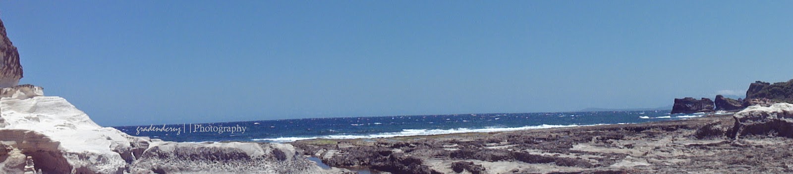
Timmangtang rock stands majestically a few meters away from Bantay Abot caves. It is located along the shore and partly by the sea. You cannot separate Bantay Abot Cave from the Timmantang Rock for they are believed to be lovers, the former being the female and the later is the male. They are collectively termed as “Lover’s Rock”. This rock is bell-shaped, hence the name Timmantang. The rock is covered with grass and bushes. (Timmangtang Rock)


Bantay Abot means “a mountain with a hole.” A hole was found at the middle of the mountain where the waves were free to flash into its walls just like an open shore until it was wrecked by an earthquake during the 80’s. It is also called “the underground sea” for on top of the cave is a lustrous vegetative cover. Inside the cave is a church that once you are inside, you do not only hear the echoing sound of the waves, the chirping of the birds but you can also feel the cool breeze of the air. It is a favorite hangout of swallows that swarm to their roost in the late afternoon. It is a very unique creation partly surrounded by the clear blue sea. Its shore has white sand mixed with fragments of shells and rocks that can be made as a décor. Parts of the shore are forms of rocks where you can sit and relax and enjoy a lucid view of the wide sea and verdant mountains.(Bantay Abot)


It's just so nice seeing a lot of places. You get to learn more of their history, the must-see places that they offer plus the experiences that you gain out of it. With the natural beauties offered on hand, you tend to appreciate these wonders which you will never get from the comforts of your home.  Indeed, I dreamed of going to Ilocos Norte some day and I did.  The travel may have been long but it was really worth it! However, I still plan to go back there once again soon because there were still a lot of places that I missed to see.

Bacarra Church and Belltower, Bacarra, Ilocos Norte

The brochure that we got from the Visitor's Center in Burgos, Ilocos Norte has helped us find our way to the St. Andrew the Apostle Parish Church (Bacarra Church).  If not for this, we could not have seen it.  This church together with the tower and the convent were constructed by the Augustinian Friars in 1593 and was inaugurated in 1782. 
Historical Marker of the Church
This church has been damaged several times and the last of which was in 1983 when it was hit by a magnitude 7.8 earthquake.

St. Andrew Parish (Bacarra Church)
The church facade was originally of Baroque architecture.


Inside the Bacarra Church


Side of the church facing the Belltower


The Belltower
Its bell tower, more popularly known as “Torre Ti Bacarra” or “torre”, was the town's most prized heritage. It was constructed by Fr. Bergier, OSA in 1828. It stood 50 meters high with three storeys. It has a 16 x 16 meter base that gradually narrows at the top. Topping it is a heavy bronze bell.
On 19 March 1931, the feast of Saint Joseph, the bell tower suffered its first major destruction. An earthquake caused the tower to have a leaning posture from the earthquake for more than half a century. The locals called it the “Bowing Belltower of Bacarra” while the tourists referred to it as the “Leaning Tower of the North.” In 1971, another earthquake further deformed the tower, yet the ruins attracted even more tourists. After the earthquake, the tower was preserved by placing support on the walls of the remaining structure. In 1981 and on 17 August 1983, another earthquake occurred and the tower finally gave way and was left with its present flattened top.
In 1973, the tower became a national cultural treasure according to Presidential Decree 260.(Bacarra Belltower)
Fallen Debris of the Belltower


Because of its domeless structure brought about by the earthquake in 1983, it has earned its title "The Dignified Domeless Belltower in Asia". 


Beside the church is the Museo de Bacarra which was recently opened to the public, however, when we went there, it was closed.

Bacarra Church Museum


Bangui Windmills, Bangui, Ilocos Norte

There were two reasons why my friend really wanted to visit Ilocos Norte: first she wanted to see the Paoay Church and second was to see the Bangui windmills. With only these two in mind, we really had no idea where to head to except to these places.  Dennis has researched about Ilocos Norte, after we went to Vigan in 2012, however, what I can remember with what he mentioned was the Juan Luna Shrine in Badoc, Ilocos Norte. He said that it was just about an hour trip from Vigan. Our trips back then were basically visiting historical spots and places of historical significance. With this, I knew that this was not their cup of tea.  We were just tag-alongs so I could not force my issue. 
We stopped by Vigan, Ilocos Sur for a wonderful experience of a lunch in a carinderia, after which we continued on with our journey. In about an hour, finally, we were already in our place of destination. Everybody got excited when we saw the marker of Ilocos Norte.  Of course, we had pictures taken by that marker.  It was not really that dangerous taking pictures in the middle of the highway because there were less vehicles going towards the tip of Northern Philippines.  Aside from that, there was also an usher who would signal us if a vehicle was approaching.

We went to Paoay Church first and then headed on to the Bangui windmills. It was almost sun down when we approached Bangui, Ilocos Norte.  Actually, I fell asleep on our way going to Bangui but I woke up because I sensed that we were going downhill so fast and my friend, Gemma, cautioned his son who was driving, not to drive so fast. I woke up with the beautiful sight of gigantic windmills lined along the shore. I got awestruck by its size and magnificence. Now, I was seeing for real what I just used to see on pictures.

Sunset by the Bangui Windmills
Bangui Windmills
 

From my research, it was in 1990 when former Governor Ferdinand Marcos Jr. aggressively pursued to develop a power plant in Ilocos Norte due to power outages.  A wind resources analysis was done by the National Renewable Energy Laboratory (NREL) and identified Bangui as an amenable site for wind power installation. Each windmill has a height of 70 meters with 41-meter blades. The Northwind power Development, a Danish power firm have supplied the wind turbine units. The windmills supply about 40% of the needs of the Ilocos Norte Electric Cooperative. I have observed that they are still on the process of adding more windmills and I have also seen how big the size of a piece of blade.


Miniature Windmills
Although these windmills are serving Ilocos Norte as a source of their electricity, for the general public, it is a must see tourist destination. This attraction is open to the public with no admission fees. There were no gates. The seashore was not sand, instead it small stones and gravels. It is evident that this spot has also served as business opportunity for the townspeople because there were spots there where they sell souvenir items such as miniature windmills, accessories as well as t-shirts. It was almost 6 pm when we left Bangui Windmills. While on our way back to the van, I still took one last look at the beautiful sunset.


The next day, we spotted a tourist center. We were able to get a copy of the brochure of Ilocos Norte.  From here, we were able to plan for the other "must-see" places in Ilocos Norte before heading home.  The tourist center also served as a view deck of the Bangui windmills.  From afar, you can't really help but to appreciate its beauty.  Near or far, the Bangui windmills is really an attraction that you should not miss when heading towards the northern tip of the Philippines.


Sunday, April 27, 2014

Cape Bojeador Lighthouse, Burgos, Ilocos Norte

I have always been amazed of lighthouses.  When I went to the US in 2011, Dennis brought me to Kenosha, Wisconsin where I saw two lighthouses. I even attempted to climb the stairs in one of these two lighthouses just to have my pictures taken. When we went to Corregidor in 2012, I saw the old Spanish lighthouse which was located at the highest point of Corregidor Island. In 2013, I saw the Cape Bolinao Lighthouse in Pattar, Bolinao, Pangasinan. All of these have their own significant historical backgrounds.

This time, I saw another Lighthouse in Burgos, Ilocos Norte, the Cape Bojeador Lighthouse. It is also known as the Burgos lighthouse.  This is one of the cultural heritage structures in Ilocos Norte. Actually, it is the main tourist attraction of the municipality of Burgos. The lighthouse stands on top of Vigia de Nagparitan Hill, overlooking Cape Bojeador. The cape used to be very busy as galleons used to pass by. It’s been more than 100 years since it was established and up to this time, it is still fully functional — a beacon signaling to ships that they have entered the Philippine Archipelago from the north. This lighthouse is one of the highest elevated Spanish colonial lighthouses in the Philippines.


We headed for the Cape Bojeador lighthouse going upwards through a winding road. We stopped at the small parking lot where vendors of souvenirs were lined on the side of the road. From the base, we had to climb a flight of steps. You have to be careful in going up as the steps are not in their best condition. However, in spite of this inconvenience, the view of the South China Sea on the way up was just so amazing. I haven't reached the gate yet but I couldn't help clicking my camera because of the very beautiful site in front of me. The lighthouse and the building in its antiquity, I have found it so attractive. It seemed to me that its height commanded authority in silence. It was very peaceful and very cinematic, as well.
Historical Marker of the Lighthouse

Climbing the stairs can leave you breathless but the fresh air compensates for your need of oxygen. It was very, very windy. However, avoid looking up, as you are climbing the steps because you could get dizzy. It could give you an illusion that the tower is about to fall down on you due to the movement of the clouds.
Brief History of Cape Bojeador

As you approach the entrance, it would lead you to a flight of stairs going up. It is currently undergoing renovation.  


The lighthouse tower is 65 feet tall and is octagonal. It is made with bricks crowned with a bronze cupola.The lighthouse was erected as part of Spain’s master plan of illuminating the Philippines. The initial design was by Magin Pers and Pers in 1887 but was completed by Guillermo Brockman’s Lighthouse Service.   On March 30, 1892, it was lit for the first time. 


As you enter the main building, you can see a small room on the left side which is dedicated as a small museum. It is not actually in its tip-top shape but in here, you can see some memorabilias about the lighthouse and its history.


I spent sometime inside the museum because I got caught up with the preserved old magazine cut-outs and pictures of the Cape Bojeador Lighthouse. You could also see in a glass casing was the miniature copy of the lighthouse. I went out from the museum towards the lighthouse. There was a flight of steps going up to the entrance of the lighthouse however, we were not able to enter as there were men who were renovating it. We just contented ourselves taking pictures of it from the outside. It would have been best if, at that time that we went there, it was open.  I can just imagine how the view from the top of the lighthouse would look like.

Kapurpurawan Rock Formation, Burgos, Ilocos Norte

The Kapurpurawan Rock Formation is located in the rocky coast of Burgos, Ilocos Norte.  It is not along the highway so if you have no idea about the different tourist destinations of Ilocos Norte, you will definitely miss this. From the highway, you will need to travel about 3 kilometers to reach the drop-off point and walk about 10 minutes to the rock formations. 

Paved steps going down to the coast
As we were going down, I really had no idea on how it would look like. In my mind, since it was named kapurpurawan or puraw meaning white in Ilokano, It was just simply several white rocks that I would see.


My companions, since they were a lot younger than I am, decided to walk. I chose to ride the horse since the weather was too humid and hot. A horseback ride costing a 100 pesos would not really hurt, so I opted for it instead of walking.  It was also an experience for me as I only had the experience of a horseback ride in Baguio City then.


There was a paved walkway which made it easier to walk. The advantage of walking is that you get a better picture of the picturesque landscape than horseback riding. The paved path is indicative of the presence of tourists frequenting the place.


View of the Rock Formations from afar


In Ilocano, “Kapurpurawan” or "puraw" means white. Most of the rocks formations are shaded by sparkling white in color. This beautiful tourist spot was created by forces of wind, water and waves from the ocean. In Science, it is a sedimentary rock formed by sedimentation, where the deposition of particles carried by fluid flow, created rocks on diff. shapes and formations. The breath-taking scenery of the ocean adds beauty of the place.(Kapurpurawan Rock Formations)

The beautiful scenic spot will definitely wear off all the stress brought about by the scorching heat of the sun.  It is very beautiful.  On our way, I was asking the guide if indeed it was a natural formation or a man-mad formation.  He said it was a natural rock formation formed over ages. At first, I did not believe him but when I was there, I found it out myself that indeed, it was real. 

A Panoramic View

From a distance, I saw a small ship on top of the rock.  Some would say, it was the shape of a bird. But, for whatever shape it was, this is a must-see place that one who is going on a road trip to Ilocos Norte should not miss. As we got closer to the rock formation I saw how magnificent this thing was. It was mother nature's work of art...a masterpiece.


This amazing beauty would just make you stand in awe.  In the middle of the white rock formations, you would not help but a have a 360 degrees turn to appreciate its magnificence. An add-on to this is the panoramic view of the waves graciously splashing on the rocks.


The Kapurpurawan Rock Formations have also gained the title "The Jewel in the North".